Easy to use cloud based schedule validation with Schedule Validator: Learn More.

Trimble Business Center

Construction Site and Corridor Data Prep and Planning Software

The following six subscription editions of Trimble Business Center are available, depending on your needs:

  • Site + Field – For data prep, survey, surface, alignment, and corridor
  • Survey + Mapping – For complete survey, scanning, and mapping workflows
  • Construction – For complete data prep, survey, takeoff, mass haul, and advanced corridor planning
  • Aerial Survey – For UAV processing and survey
  • Mobile Mapping – For mobile mapping customers focused on MX9 processing
  • Enterprise – For all core surveying and vertical surveying and construction workflows mentioned above, including aerial surveying and tunneling

Trimble Business Center calculates earthwork and material quantities for bids, preparing data for construction stakeout, building 3D models to optimize machine operation, track productivity and deliver first-class as-built documentation — seamless and efficient.

  • Save time and money by seamlessly managing data between the office and the field
  • Win more bids by quickly preparing accurate, 3D constructible models for machine control and construction surveying
  • Reduce rework by ensuring data is clean, current and delivered in the right format
  • See how easy it is to do a takeoff or quantity estimate using a .pdf file or other data


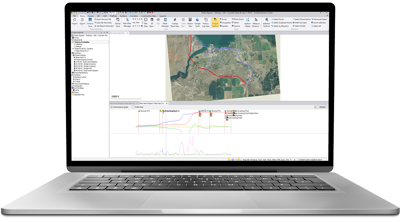
Speed up the bidding process and increase profit margins with advanced construction site modeling capabilities.

The Problem Trimble Business Manager solves:

Rapidly create project site takeoff and quantity estimates with earthwork summary reports

Industry Applications
Construction 
  • Data preparation for machine control
  • Site takeoff and quantity estimating
  • Road and corridor takeoff and quantity estimating
  • Utility modeling
  • Drill and pile plans
Survey
  • Field data
  • Adjustment and COGO
  • CAD and drafting
  • Surfaces and volumes
  • Takeoff and mass haul
  • Trimble VISION and aerial photogrammetry
  • Scanning and point clouds
  • GIS
  • Mobile mapping
Marine
  • Hydrographic surveying
  • Dredging surveys and volumes
  • Large multi-beam data set management
  • Marine and land construction design

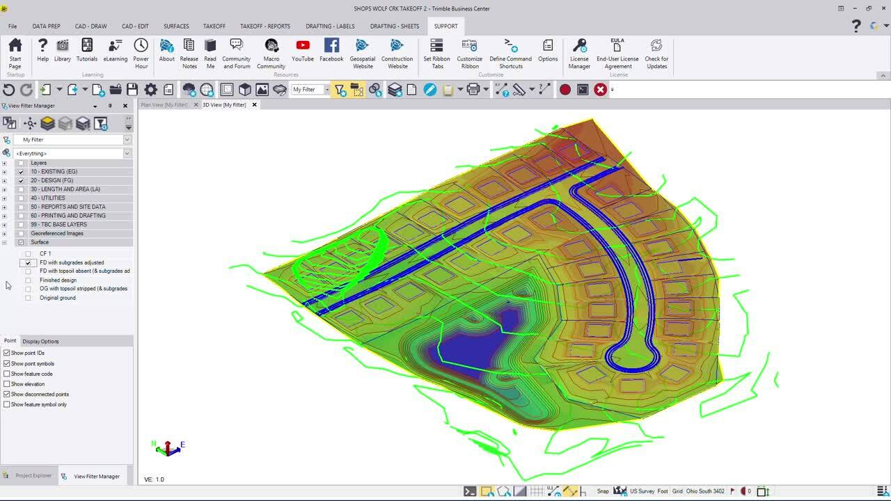
There’s Now an Easier Way

to create quantity takes offs from 2D or 3D data